Showing posts with label Environmental Quality and Sustainability. Show all posts

Monday, May 23, 2011

Lands in Need of Protection

More protection has been put in place since the adoption of the 2001 Legacy Plan for watersheds, floodplains and wetland protection. However, Natural Heritage sites are for the most part in private ownership and are not protected from development.

How important is it to protect these sites?

What policies or strategies can be developed that will make land use conservation and the reuse/redevelopment of existing sites economically feasible and a desirable option for future development?

Give us your thoughts -- click "comments" below:

Open Space, Land Conservation and Farmland Preservation

Open space is preserved in a number of ways in our community including through the purchase of property, obtaining easements, and the preservation of farmland.

How can we as a community further incorporate land conservation into our goals for the future?

Give us your thoughts -- click "comments" below:

Environmental Pollution Prevention

Pollution issues are numerous and complex.

What sources of pollution (air, water, land) are of the greatest concern for our community?

What tools should be utilized to better protect our natural environment from future pollution?

Give us your thoughts -- click "comments" below:

Noise & Light Pollution

Noise and light pollution are becoming bigger issues as more of our community urbanizes.

Is noise and light pollution an environmental issue that should be further addressed within the Legacy Update?

If so, what policies or regulations should be implemented to better address these two issues?


Give us your thoughts -- click "comments" below:

Urban Forestry and Tree Preservation

Winston-Salem adopted its first comprehensive tree ordinance in 2009 which covers both tree removal and tree planting on sites that come in for development review.

Is the current tree ordinance or its application only to the City of Winston-Salem sufficient?

What other tools should be used to preserve our existing tree canopy and promote its expansion?

Give us your thoughts -- click "comments" below:

Green Building (LEED)

Green buildings have multiple benefits for land, the environment, health, and natural resources.

Should green building practices be required with new building design, or are incentives a more appropriate method of incorporating green building practices into future development?
If so, what type of incentives would be most beneficial to achieving our goal of sustainable growth?

Give us your thoughts -- click "comments" below:

Low-Impact Development (LID)

LID practices make site design environmental-friendly and reduce infrastructure costs.

What role does Low-Impact Development practices have in the future growth of the county?

Should LID practices be incorporated into the site design requirements that are reviewed by City and County staff?

Give us your thoughts -- click "comments" below:
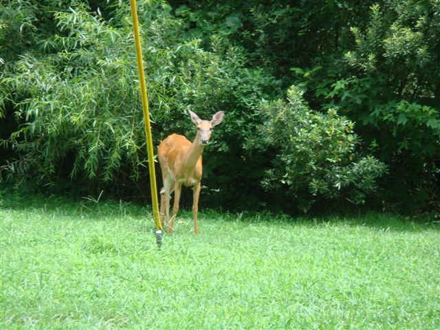
Sustainable Development

Sustainable development needs to be addressed on three levels: individual buildings, site design, and neighborhoods.

How can we as a community promote sustainable development at all three levels within our future growth? 

What incentives and/or regulations can the City of Winston-Salem and Forsyth County use to promote sustainable development?


Give us your thoughts -- click "comments" below:

Alternative Energy Sources
and Energy Conservation

With the current national discussions on decreasing availability of petroleum and rising energy costs, it is important to consider the use of alternative energy sources and energy conservation when discussing the future of our community. This would be applicable to both how we fuel our cars, as well as how we serve our homes and businesses.

What alternative energy sources – water, solar, wind, bio-fuel – would be the most appropriate for Forsyth County?

What policies or tools can be implemented in the future to encourage conservation of energy?


Give us your thoughts -- click "comments" below:

Sunday, May 22, 2011

Lands in Need of Protection: Natural Heritage Areas

Natural Heritage Inventory Sites are environmentally-sensitive sites in need of protection. The NC Natural Heritage Program inventories, catalogues, and supports conservation of the rarest and the most outstanding elements of the natural diversity in our state. The Inventory for Forsyth County was completed in 1997, and 23 sites were indentified that included important wetlands and forests, special habitats of plants and animals, rare species occurrences and significant rock outcrops. Six of the sites are under some form of protection, but the remainder are privately owned and not under any form of protection.

Lands in Need of Protection: Floodplains and Wetlands


Floodplains are broad, flat, flood-prone lands adjacent to creeks. They are inherently hazardous and costly locations in which to build and where development should be limited. Federal, State and local agencies have established various and legal requirements, public policies and guidelines to manage activities in flood-prone areas. Standards for Forsyth County are included in the Unified Development Ordinances.

In 2008, revised floodplain regulations and FEMA Flood Maps were adopted by the City and County. The revision to the regulations included a one foot increase in freeboard (the height above flood level) used to determine the “Regulatory Flood Protection Elevation”. This elevation is now determined to be the “Base Flood Elevation” (BFE) plus two feet of freeboard. If the BFE has not been established, the Regulatory Flood Protection Elevation is determined to be two feet about the highest adjacent grade. This revision not only improves flood management but also potentially reduces the cost of flood insurance to the property owner.

There have been discussions by City Council about reducing the area of encroachment within the “floodway fringe” from 50% to 15%. However, no action has taken place beyond this discussion.

Wetlands are defined as areas inundated or saturated by surface or ground water at a frequency and duration sufficient to support a prevalence of vegetation typically adapted for life in saturated soil conditions. Wetlands generally include swamps, marshes, bogs or similar areas and are defined by soil type. When developing areas that include wetlands, a permit must be obtained from the N.C. Division of Water Quality.

Lands in Need of Protection: Watersheds

Water-supply watersheds have specific State-mandated protection regulations. These regulations attempt to maintain or restore the natural stormwater infiltration and purification process by:
  • Limiting housing density by restricting the maximum number of housing units per acre
  • Limiting the built-upon area, or the amount of land covered by pavement and structures
  • Maintaining natural vegetative buffers along streams
  • Requiring engineered stormwater controls that trap sediment and other pollutants before reaching streams
Protected watersheds in Forsyth County include Salem Lake, Abbotts Creek, Lake Brandt, Oak Hollow, Kernersville Lake, and the Yadkin River. Each watershed is regulated according to State classifications.

Saturday, May 21, 2011

Reusing Existing Development

By encouraging the redevelopment of existing brownfield (business sites with potential contamination) and greyfield (abandoned big box, industrial or shopping centers) sites, prime open space can be conserved while still allowing for continued growth and development. Adaptive reuse of existing development and the preservation and use of our historic structures will also allow for land protection while allowing for growth and development.

Transfer of Development Rights

While the preservation of land through the Transfer of Development Rights (TDR) is used in other parts of the nation to preserve land, it has not been used in North Carolina. These programs can be quite complex and involve the “sale” of development rights from designated areas to other property owners in receiving areas wanting to increase the overall density of their development projects.

Piedmont Land Conservancy

Another major player in preserving open space in Forsyth County is the Piedmont Land Conservancy (PLC), a nonprofit land trust that serves Forsyth County and eight surrounding counties. The mission of the PLC is to protect natural and scenic lands, farms and open space in Piedmont North Carolina to enrich the quality of life for Piedmont communities and for future generations. To date, the PLC has protected approximately 275 acres of land through conservation easements at 11 locations throughout the Forsyth County including: Camerille Farms in the Mill Creek Basin; the Emily Allen Wildflower Preserve; the Friedburg Marsh; the Haw River Headwaters; Spach Farm located off Silas Creek Road; Black Walnut Bluffs; Black Walnut Bottoms; the Myers Tract ; Muddy Creek Bluffs; the Apple Orchard (the previous five sites are in or near Bethania); and the Martin Mill Muddy Creek Floodplain.

Friday, May 20, 2011

Farmland Preservation

Conservation easements/ purchase of development rights are the primary tool for land protection for two programs, the Forsyth County Farmland Preservation Program and Piedmont Land Conservancy. Forsyth County was a pioneer in farmland protection in the 1980s. The Forsyth County Farmland Preservation Program created in 1984 is a voluntary program in which Forsyth County purchases the development rights from farmland owners. This prohibits the future development of their land for nonfarm purposes, such as subdivisions and shopping centers. The intent of the program is to provide economic incentive to farmland owners to keep their land in agriculture or open space uses in perpetuity. The first development rights were purchased in 1987. The program helps to curb the rapid loss of good farmland to urban development, control sprawl development, preserve open space, reduce public infrastructure costs and maintain a vital link to our community’s past. The landowner is compensated for the sale of the development rights and retains title and all other rights to his or her land. Farming activities continue. The development rights are held in trust, assuring that areas with good soils and active farms will remain in agricultural uses which are an important part of Forsyth County’s open space.

There are currently 1,605 acres of protected farmland on 29 farms in Forsyth County. The main obstacle to bringing more land into the program has been lack of funding. Currently, there is a priority list of 30 farms with owners willing to sell the development rights of 1,346 additional acres of farmland if funding becomes available. Recently, regulations that allow alternative agricultural businesses have been approved. These could include wineries, horse boarding and bed and breakfasts.

Public Open Space

In Forsyth County, most public open space is in the form of park land and rights-of-way. Parks in Forsyth County provide 5,817 acres of land, much of this can be considered as open space. Greenway corridors add another 140 acres of preserved open space. Much of the land associated with greenways is through the donation of easements from private property as it comes in for development approval, though some greenway land has been purchased. There is also a fairly significant acreage in open space and landscaped areas located along the rights-of-way of major thoroughfares in the county. At present, the Vegetation Management Division of the City of Winston-Salem maintains approximately 450 acres of landscaped open area along major thoroughfares.

Air Pollution Prevention

Air pollution have been an issue for the Triad for a number of years. The EPA has set National Ambient Air Quality Standards for six common air pollutants, as required by the Clean Air Act. The six pollutants are: Ozone, Particulate Matter, Carbon Monoxide, Nitrogen Oxides, Sulfur Dioxide, and Lead. These pollutants can cause health and environmental harm and property damage. Of the six, ground level ozone and particulate matter are of the greatest concern to human health.

Ozone is created by chemical reactions between nitrogen oxides (NOx) and volatile organic compounds (VOC) in the presence of sunlight. Sources of NOx and VOC include motor vehicle exhaust and industrial emissions, gasoline vapors, and chemical solvents as well as natural sources. The size of the particles is directly linked to their potential risk to human health. The EPA is most concerned with particles 10 micrometers or smaller in size as these particles generally are able to enter the lungs.


Forsyth County and the surrounding Triad regions were recommended to the EPA for designation as a nonattainment area for the 8-hr ozone standard in 2002. Ozone is evaluated on a three year period to determine compliance with the set standards. During the 2000-2002 period, Forsyth County and other counties in the region exceeded the set standard of .08 ppm. As a result, 11 counties and 28 municipalities in the Triad, in partnership with the State and EPA, created the Triad Early Action Compact in December 2002. This Compact represented a commitment by the local municipalities to adopt air quality strategies to achieve cleaner air sooner than the federal Clean Air Act would otherwise require. In return, the EPA agreed to defer the effective date of nonattainment designation until April 15, 2008 contingent on all terms and conditions of the Compact being met. However, in March 2008, the EPA reduced the set standard for 8-hr ozone levels from .08 ppm to .075 ppm. In March 2009, the State recommended to the EPA that the Triad area (including Forsyth County) be designated as a nonattainment area under the new standard.

There are both economic and potential transportation impacts to receiving a nonattainment designation. Nonattainment areas must live within an “ozone budget” and review emissions for all proposed new industry. In worst case scenarios, federal transportation funds can be withheld for nonattainment areas.

Water Pollution Prevention

Water pollution is caused by direct and indirect contaminants. Direct sources include land uses such as factories, refineries and waste water plants. Indirect sources include contaminants that enter the water supply from soils/groundwater systems and from the atmosphere via rain water. Soil and groundwater contain the residue of human agricultural practices such as fertilizers and pesticides, and improperly disposed of industrial wastes. Atmospheric contaminants are also derived from human practices such as emissions from automobiles.

The N.C. Division of Water Quality monitors local creeks for water quality. Factors such as sedimentation, turbidity and fecal matter are monitored on select streams. Many of the problems stem from nonpoint source pollution from stormwater runoff from construction sites and developed areas. Recommendations are made by the State for improvement to local water quality.

Thursday, May 19, 2011

Noise & Light Pollution

Noise pollution is a noise that goes beyond the normal noise level to where it is no longer reasonable or acceptable, whether the noise is produced by a human, animal or some type of machine or equipment. Noise pollution can be an environmental nuisance that overexposes someone to a sound exceeding his or her tolerance level or disrupts the normal activity of human or animal life. Not only can noise pollution impact human health, but it can also cause stress among wildlife by interfering with their natural habitat and sounds of communication.

Light pollution pertains to light that intrudes on a natural setting, such as obscuring the stars at night, or excessive light such as lighting that extends beyond a property line leading to discomfort and nuisance. Excessive lighting can create glares that have a blinding effect thereby creating a potential hazard or can disrupt normal daily activity like sleep patterns. In the natural environment, excessive lighting can obscure the night sky or alter the ecosystem by introducing light in normally shaded areas. Such lighting can be disruptive to land and marine animals as they migrate or nest.